Emergency Contact
Seqwater Logo - Water for life
Low, orange flames in the foreground generate a heat wave slightly obscuring a fire officer in the background

Planned burns

As a major landholder and statutory authority, Seqwater has a responsibility to address fire management in our catchments.

We conduct planned burns before the bushfire season to help protect our local communities, properties, and the environment. These controlled burns reduce bushfire risks by managing dense vegetation and natural fuel hazards.

Hide    Show   
Home What We're Doing Planned burns

Your safety is important to us. Each year, our controlled burns reduce bushfire risks by managing dense vegetation and natural fuel hazards. Areas with the most fire risk are prioritised using data and criteria that includes time since the last burn, amount of vegetation growth and surrounding neighbourhoods.

Each of our planned burns adhere to strict guidelines set by the Queensland Fire and Emergency Services (QFES). These guidelines consider essential factors like temperature, humidity, wind speed, and direction which help to inform decisions about planned burns and ensures burns are conducted safely.

When burns will be held

Most of Seqwater’s planned burns take place between March and September. There may be some burn activity outside of this period, weather permitting. Some planned burns may be cancelled up to and including the schedule day if the weather is unsuitable.

While we can’t advise specific dates for burns, residents will receive a postal letter ahead of time. Notifications are also posted on our Facebook and Twitter pages on the day of a burn.

Find out more by downloading Seqwater's Fire Management Fact Sheet.

Schedule for 2025

Our planned burns are listed below by region. Not all planned burns on this schedule may be progressed this season, depending on conditions.

Northern region

  • Borumba Dam
  • Cooloolabin Dam
  • Enogerra Dam
  • Ewen Maddock Dam
  • Sideling Creek Dam (Lake Kurwongbah)
  • Lake Macdonald
  • North Pine Dam (Lake Samsonvale)

Central region

  • Gold Creek Reservoir
  • Clarendon Dam
  • Manchester Dam
  • Somerset Dam
  • Wivenhoe Dam
  • Mt Crosby (Mt Crosby/Kholo area)

Southern region

  • Bromelton 
  • Hinze Dam
  • Leslie Harrison Dam
  • Maroon Dam
  • Molendinar WTP
  • Moogerah Dam
  • Minjerribah (North Stradbroke Island)
  • Wyaralong Dam 

Smoke alerts and updates

Smoke alerts and new information will be updated here regularly.

Thumbnail of planned burn map near Wivenhoe Dam wall scheduled in April 2025 DWI001

Planned burn near Wivenhoe Dam Tuesday 29 April 2025

Seqwater has scheduled a planned burn near the Wivenhoe Dam wall on Tuesday 28 April 2025.

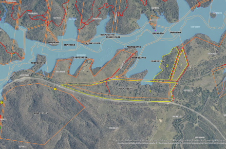
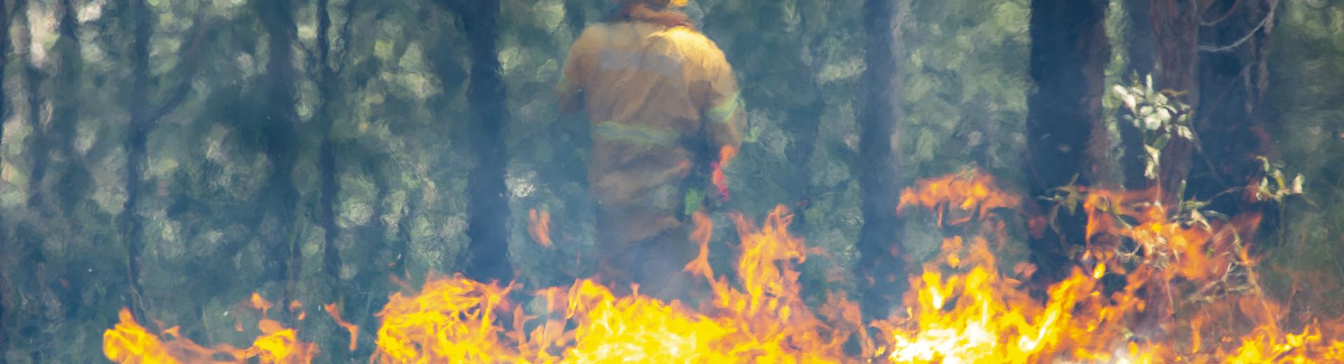
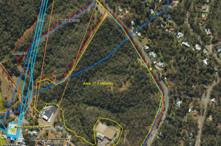
The burn is likely to produce a reasonable amount of smoke visible from the Brisbane Valley Highway near the dam wall.

If you are visiting or travelling through the area, please remain vigilant and follow the directions of staff and signage on site.

If you have a respiratory health condition, please follow the advice of your health practitioner and in case of an emergency, call Triple Zero (000).

Important information

Smoke impacts

Smoke may still drift and can stay around for up to one week after the planned burns, subject to weather.  During a planned burn, we recommend that you stay indoors, keep your windows and doors closed. Try to avoid outdoor activities in areas affected by smoke including washing and hanging out clothes to dry.

Residents with respiratory conditions

We recommend you stay indoors with windows and doors closed and use an air purifier if available. You should discuss the planned burns with your health practitioner and follow their advice. Ensure you always carry necessary medications with you.

If you start to feel unwell, please contact your health practitioner, and in the case of an emergency, please call triple zero (000).

Other information