East Bank Flood Resilience Program
Operated by Seqwater, the Mount Crosby Water Treatment Plants (East Bank and West Bank) are a critical part of the SEQ Water Grid, supplying about 50 per cent of South East Queensland’s drinking water.
Hide
Show
About the project
The Brisbane River Flood Study completed in 2017, highlighted that a number of buildings within the Mount Crosby precinct needed to be upgraded or relocated to increase the flood resilience of these assets.
The East Bank Flood Resilience Program focuses on mitigating the flooding risk to this essential infrastructure and renewing vital assets, while paying tribute to the rich cultural heritage of the site.
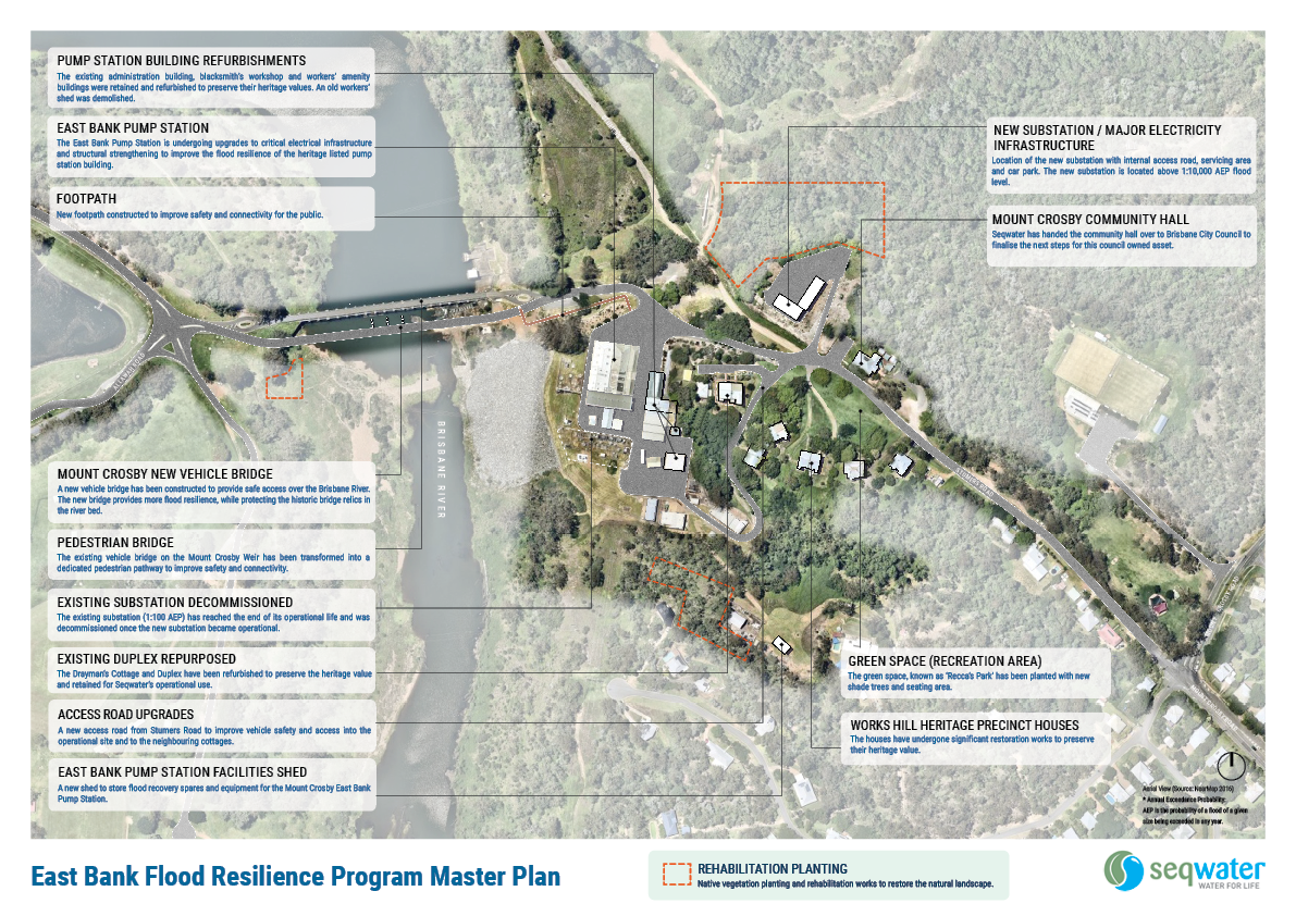
The Program includes:
Critical electrical infrastructure upgrades
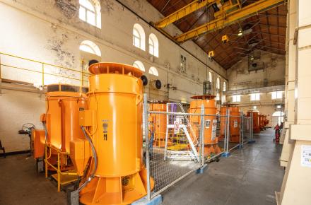
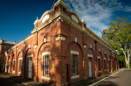
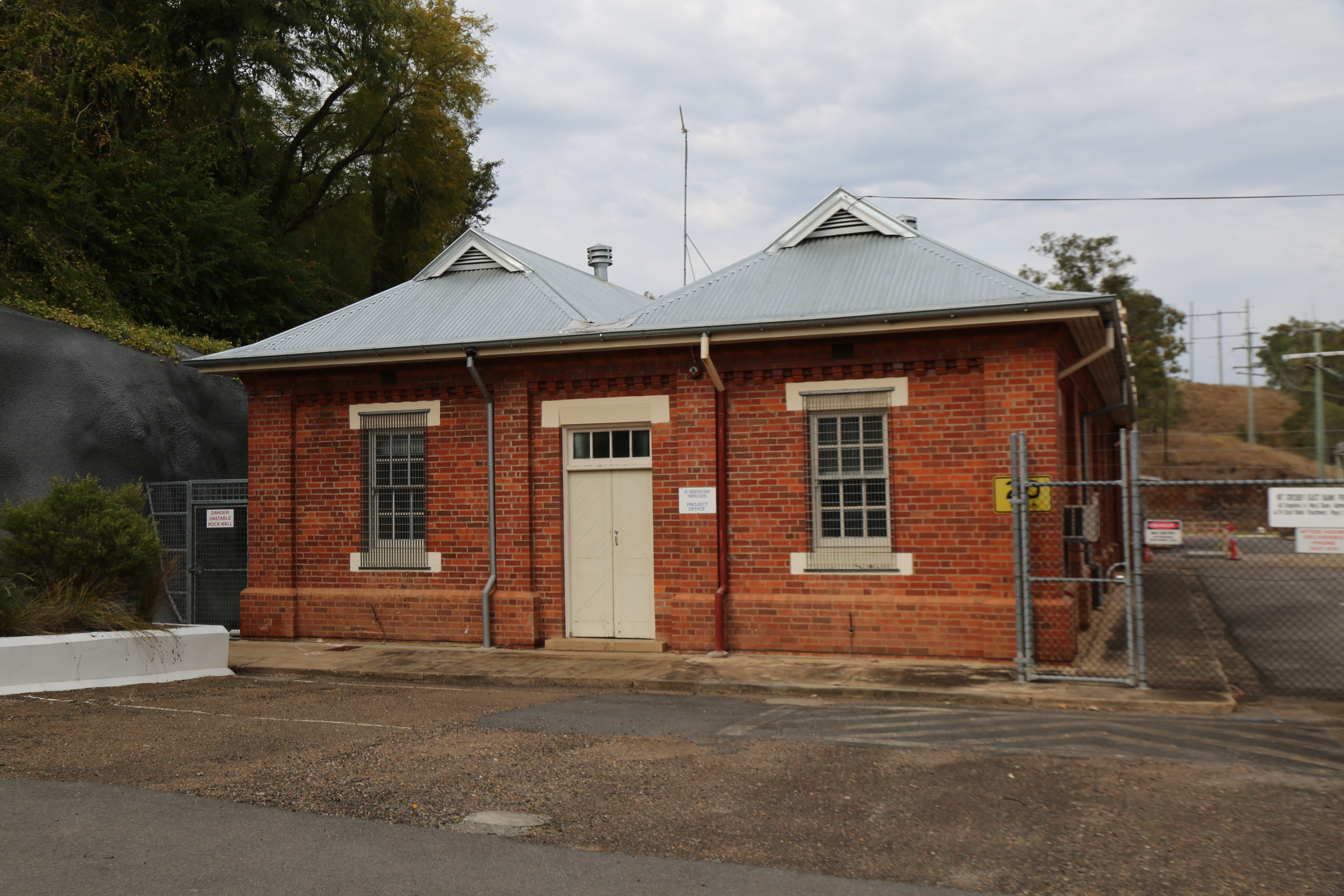
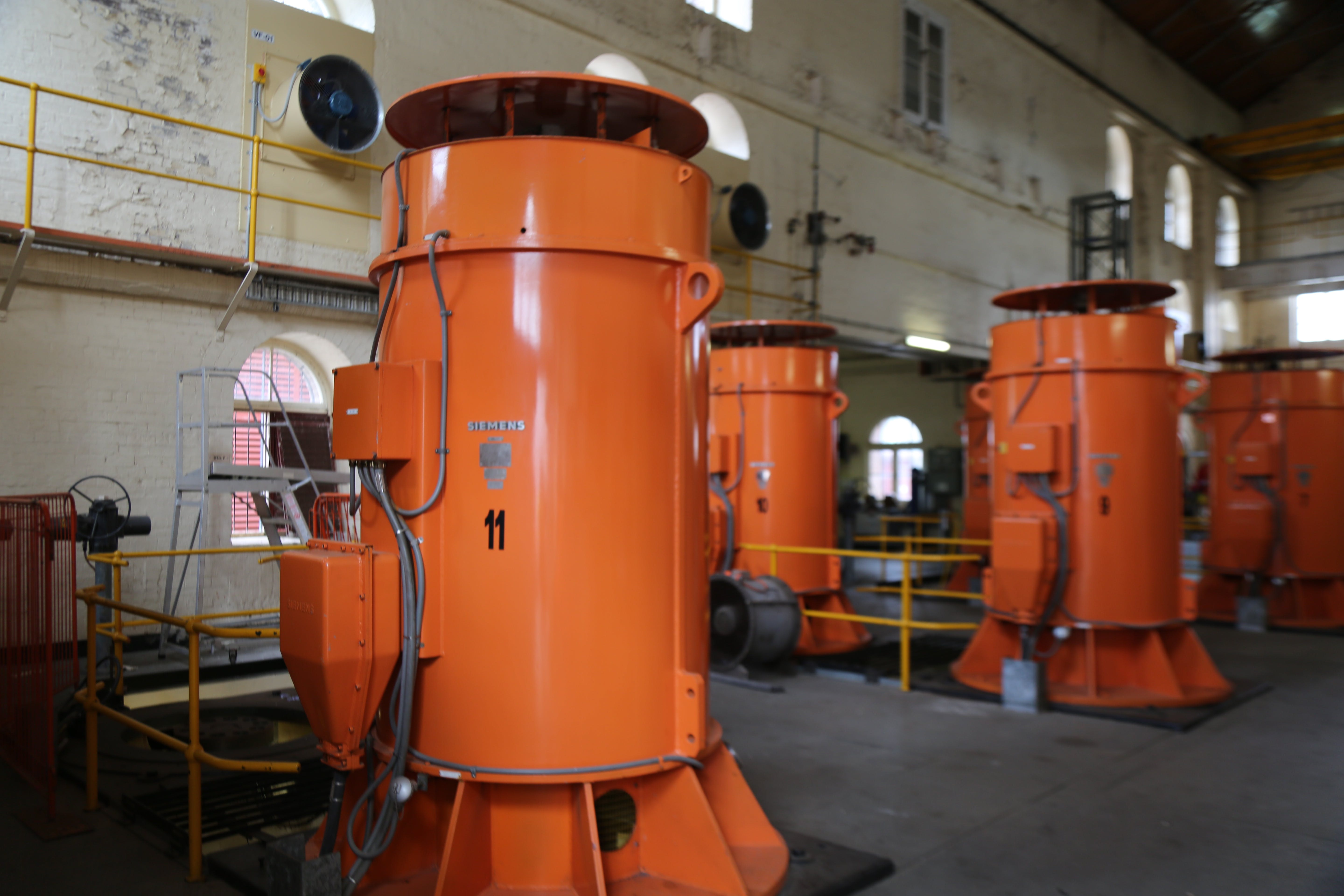
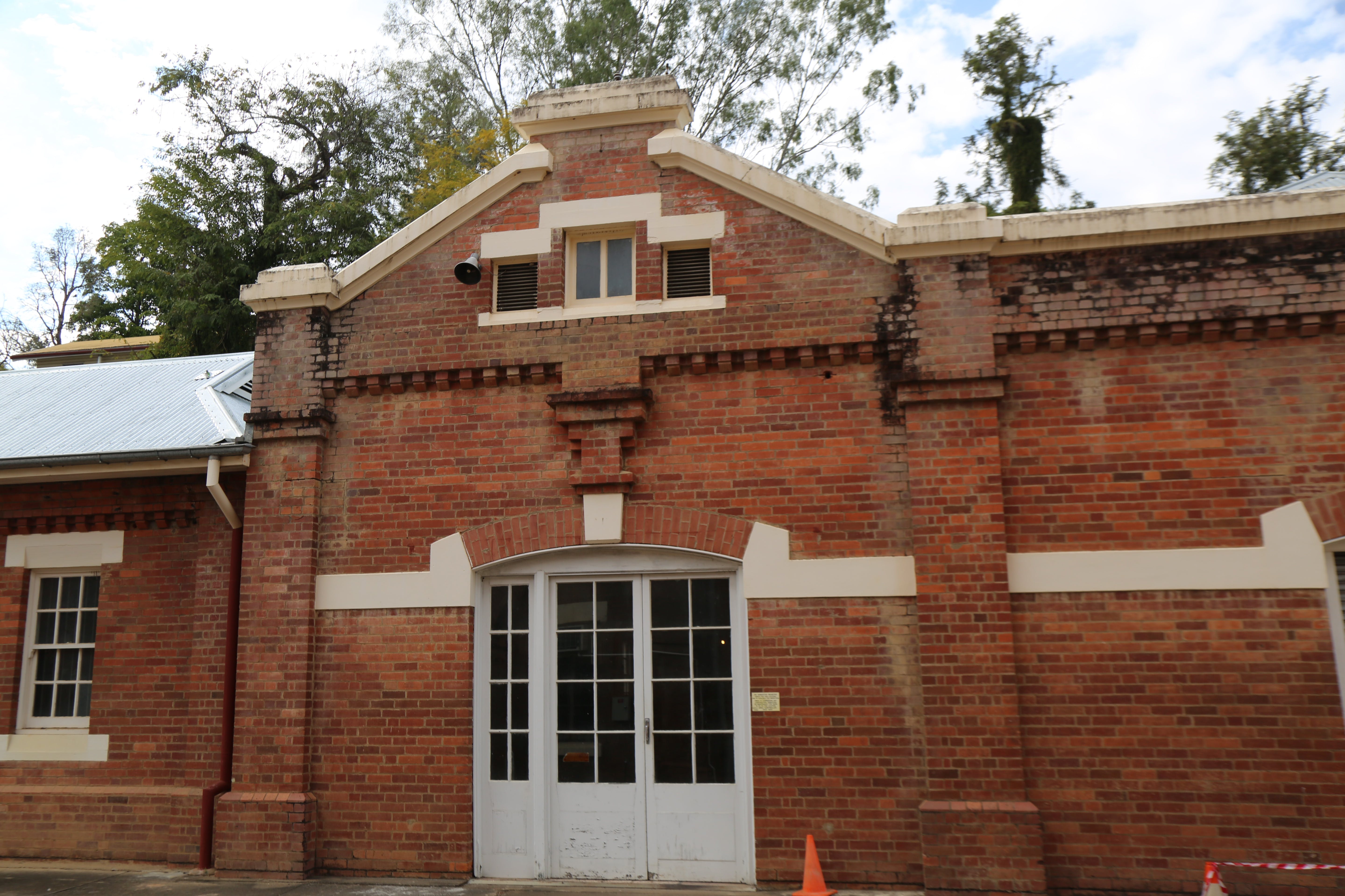
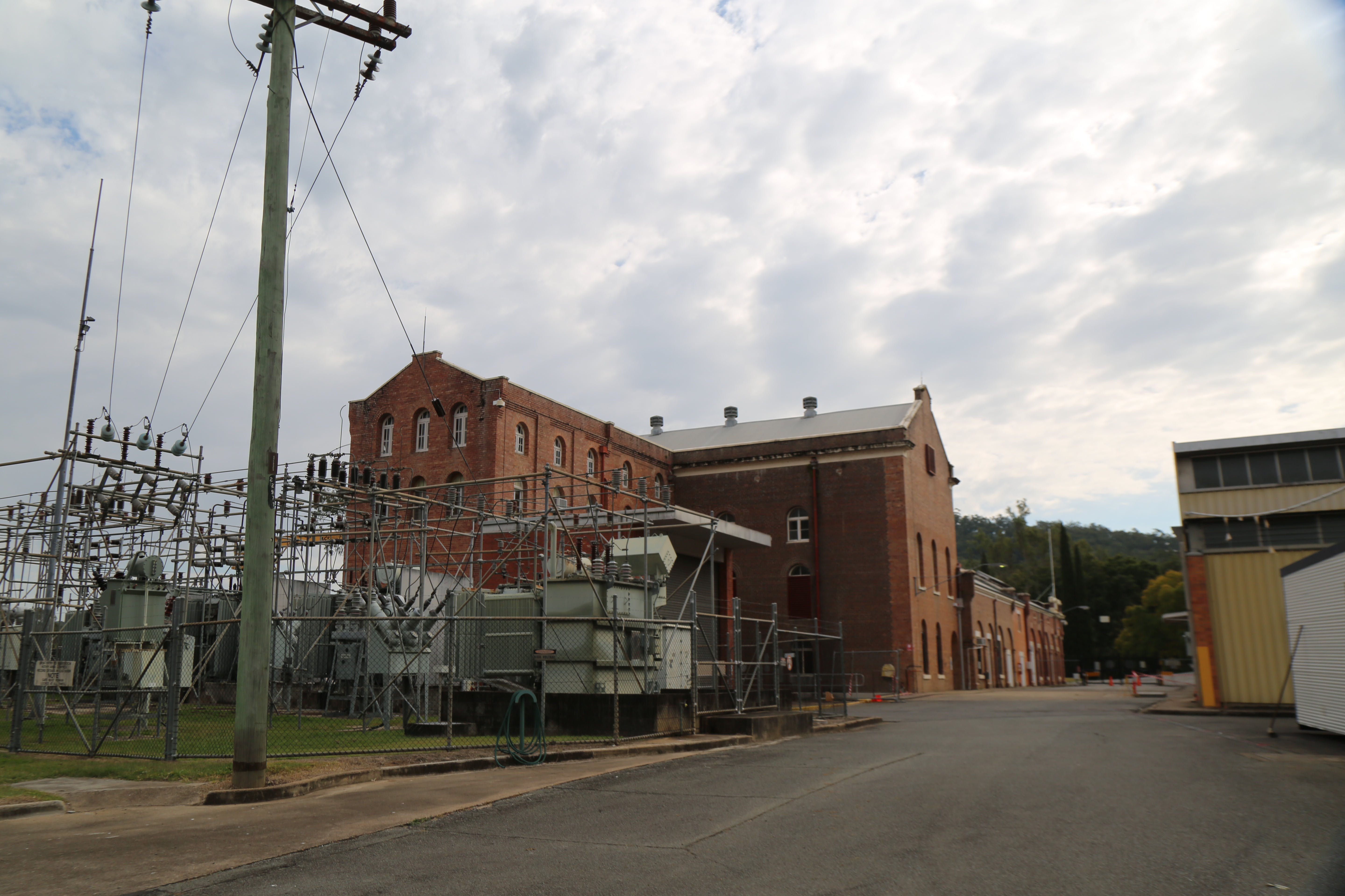
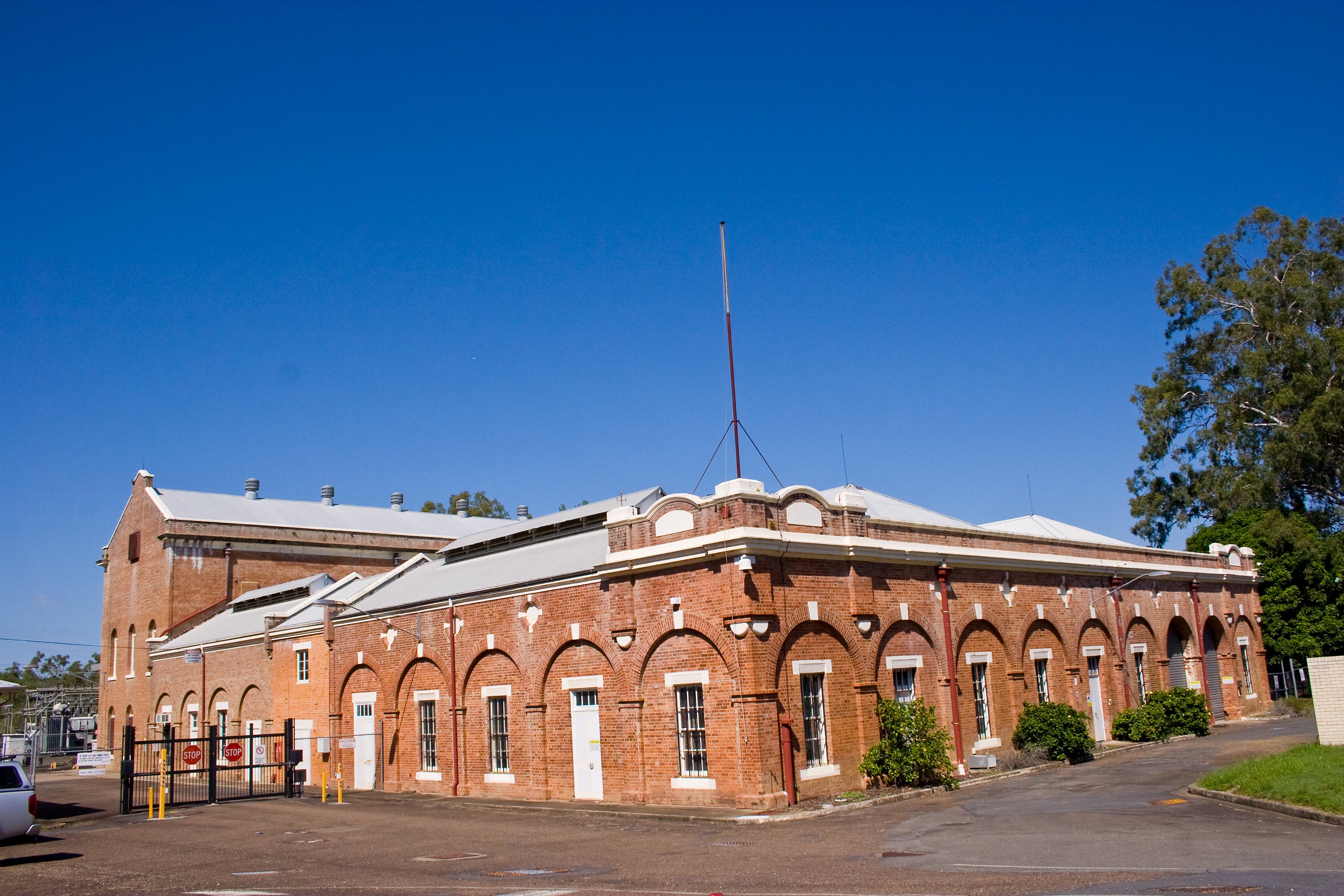
The East Bank Pump Station pumps up to 500 million litres (ML) of water a day to the East Bank Water Treatment Plant, which is a critical part of the SEQ Water Grid.
River water is drawn from the weir pool through two intake towers and into the East Bank Pump Station. The pumps then move water to the treatment plant to be turned into safe drinking water.
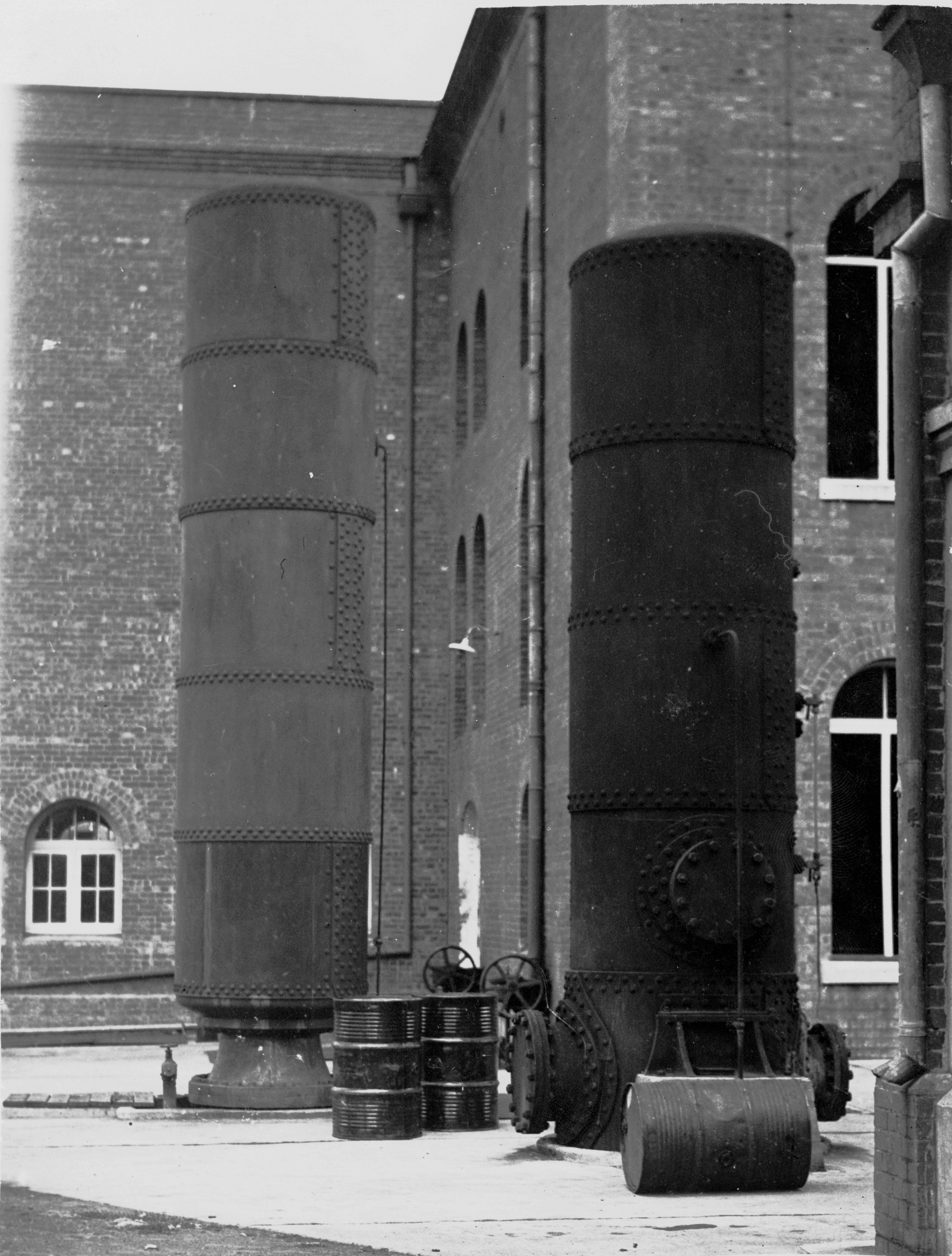
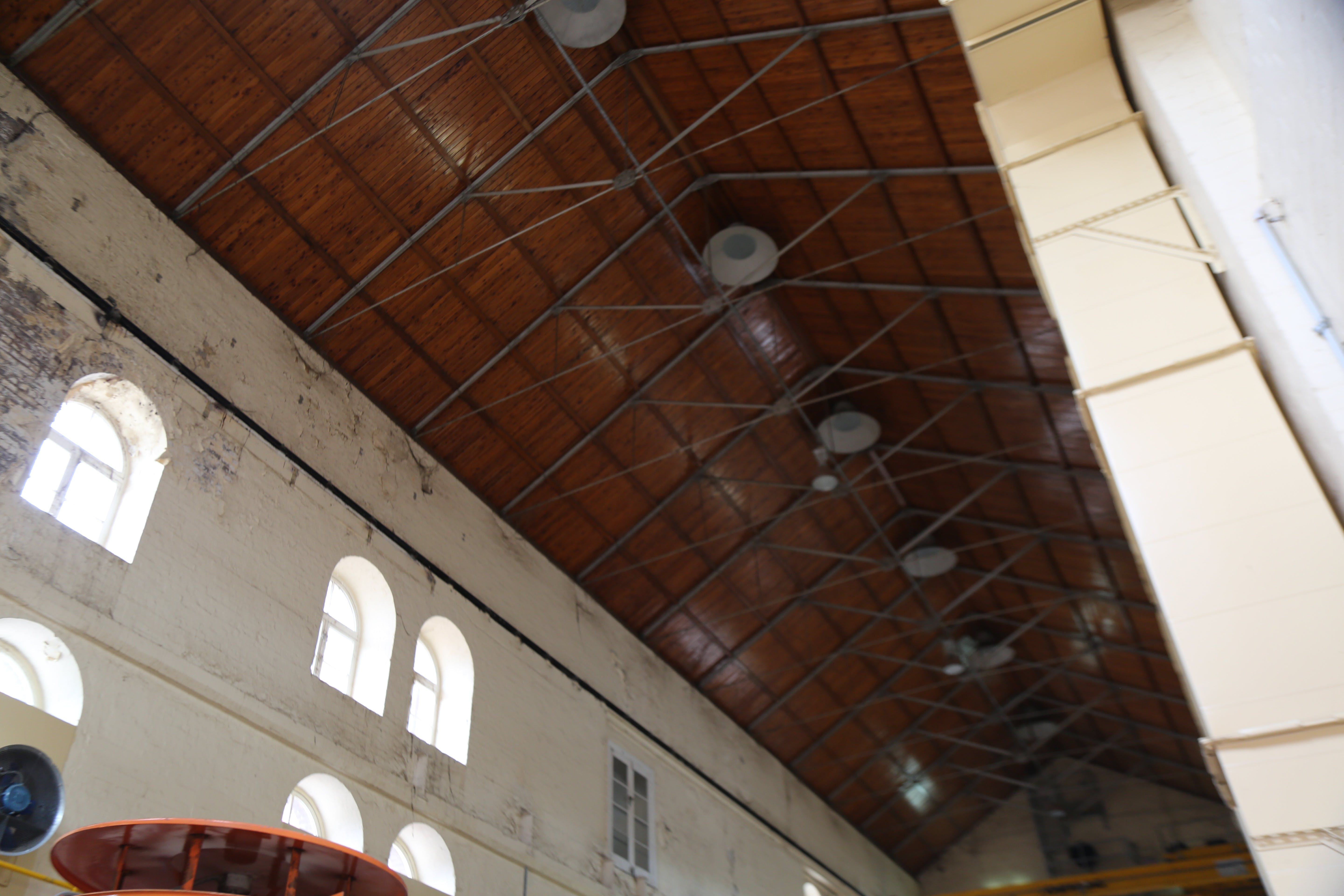
This project involves the upgrade of critical electrical infrastructure at the East Bank Pump Station, to ensure it continues to operate in peak condition.
The project will upgrade the existing motors, invest in critical spares, improve the flood resilience of the heritage-listed pump station building, and upgrade electrical infrastructure to connect to the new substation.
Construction commenced in mid-2024 and is expected to be complete in late-2026, weather and site conditions permitting.
New electrical substation
Relocating the substation ensures the pump station can be back up and running as quickly as possible after a major flood. The substation was previously located near the historic pump station building, nearing end-of-life and requiring replacement. Given the critical role of this infrastructure and flood risk associated with the previous location, constructing a new substation on higher ground helps to secure South East Queensland’s water supply during all weather.
The new substation was completed in early 2025.
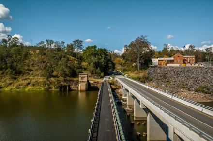
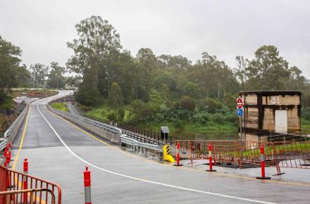
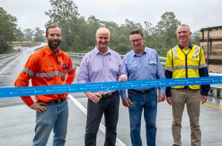
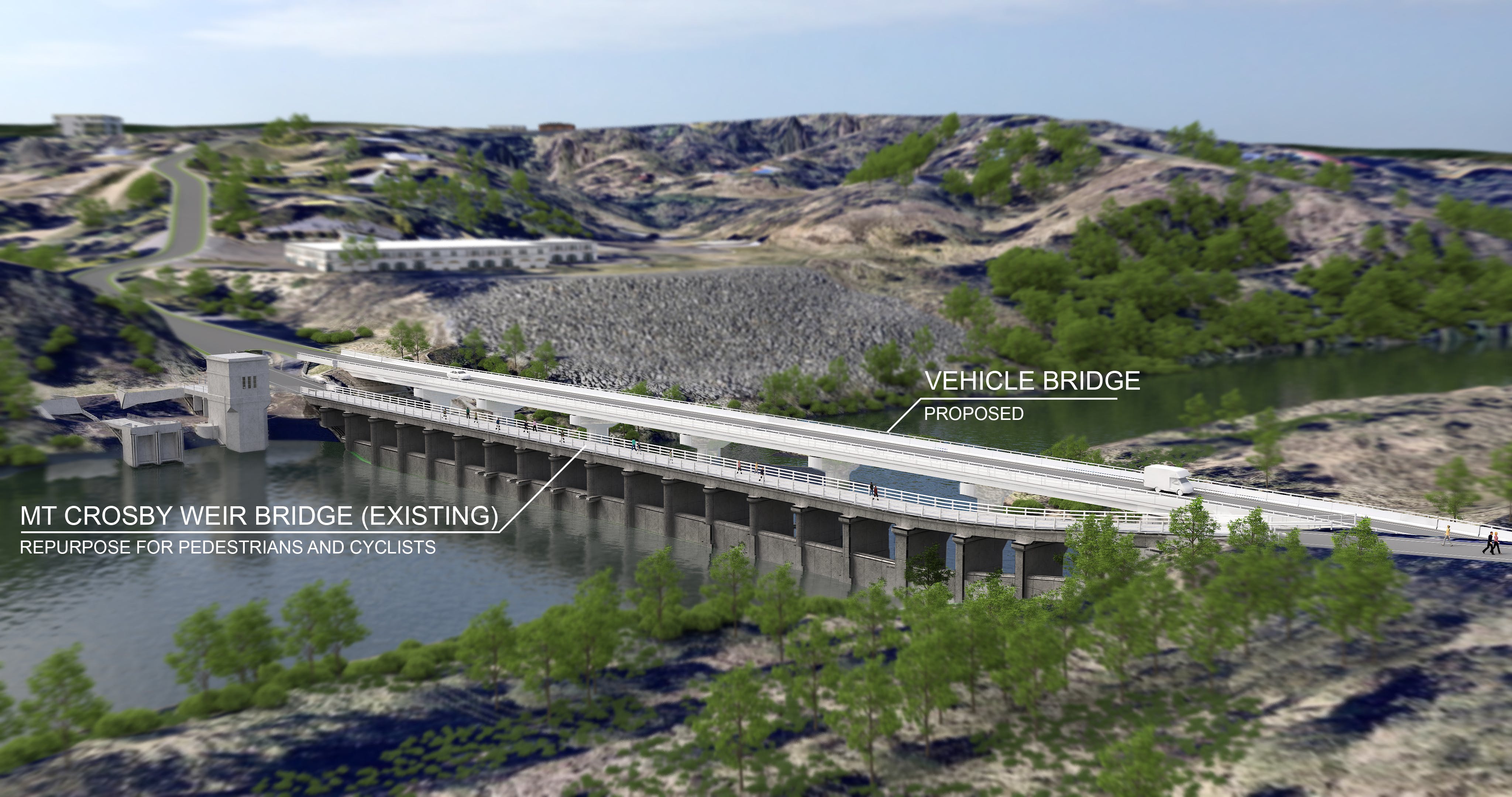
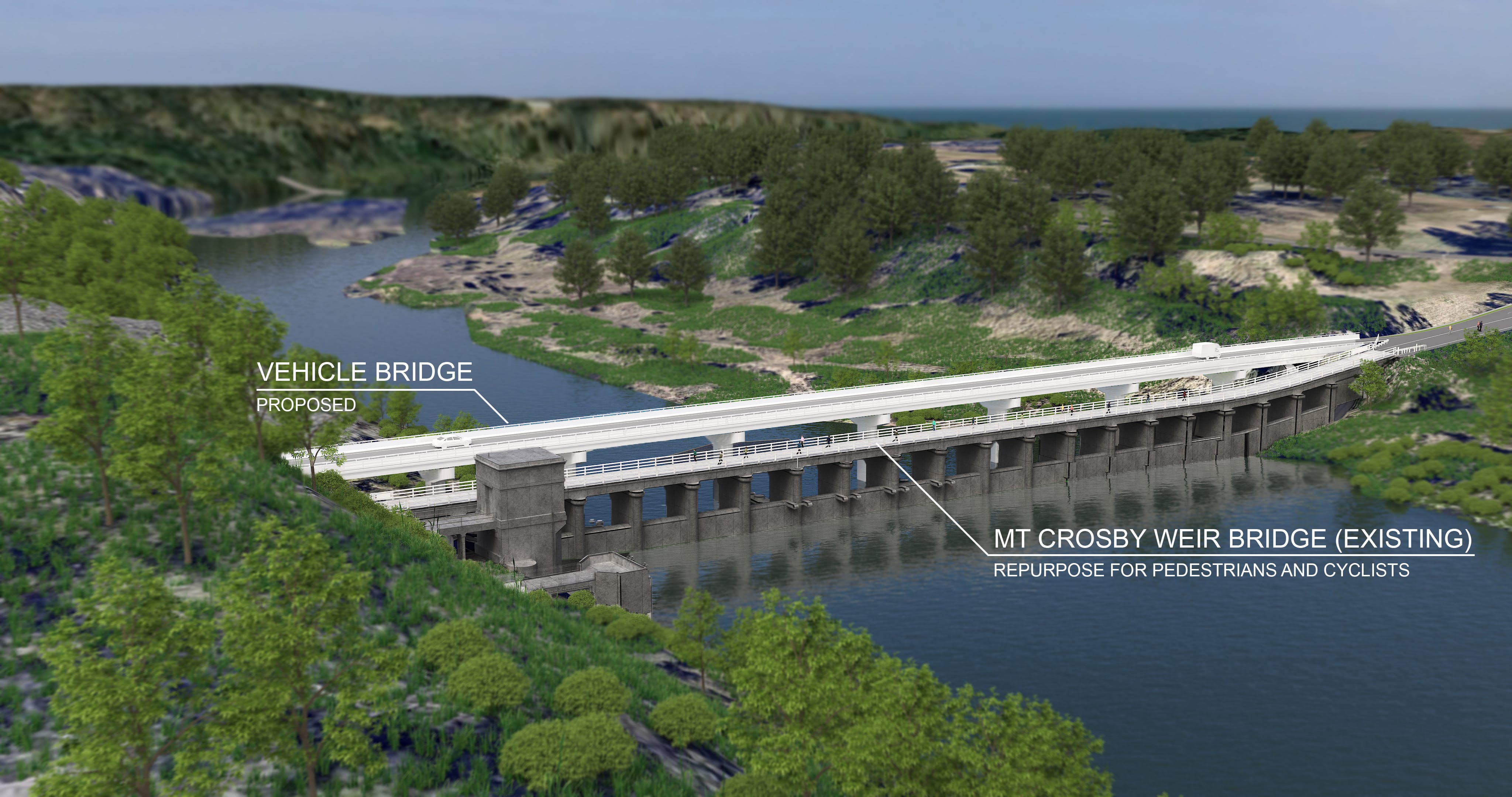
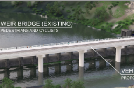
New vehicle bridge
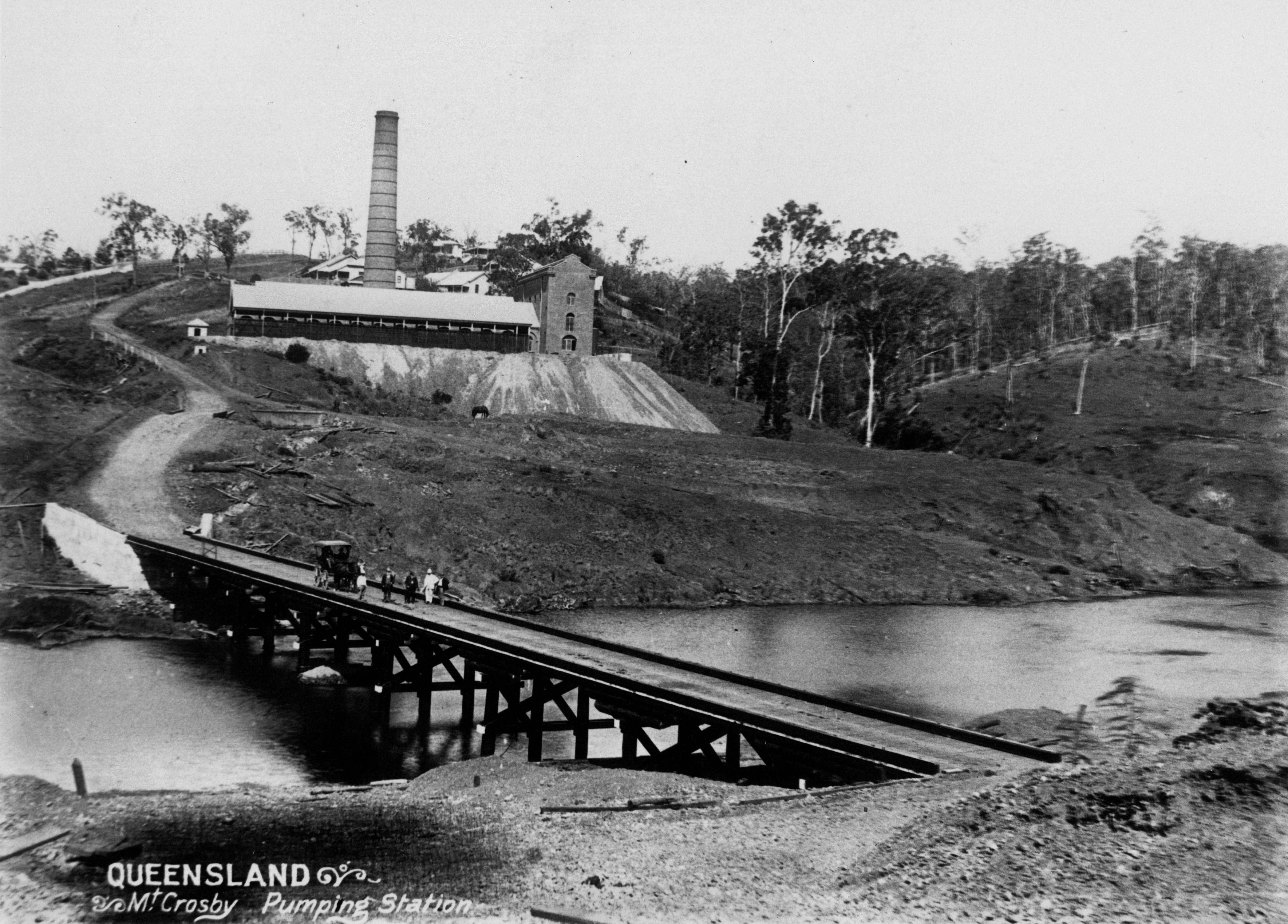
During low-level flooding at Colleges Crossing, the Mount Crosby weir bridge becomes an access point for the community. The weir bridge is also critical to Seqwater operations and provides a link between the West Bank Water Treatment Plant (WTP) and East Bank WTP.
The new three metre higher, dual-lane vehicle bridge provides greater flood resilience than the existing weir bridge. It is made of steel-reinforced concrete, 187 metres long and nine metres wide including the barriers and shoulders. The new vehicle bridge will be able to better withstand flooding and is dual lane to improve the flow of traffic and ensure large vehicles such as trucks and buses can cross safely.
The new bridge was opened in late March 2024.
The new Mount Crosby vehicle bridge (now named Explorers Bridge) is unrestricted for general access vehicle traffic loads: over size or over mass vehicles will need to obtain local road permits with the relevant authority.
The Mount Crosby Weir (constructed in 1927 to create a pumping pool for the water treatment plant and with a bridge crossing to provide access to coal for the nearby pump station) has been repurposed for pedestrians. Repurposing the existing bridge allows pedestrian access to the Mount Crosby Sportsground on Allawah Road. The pedestrian pathway opened in August 2025.
Community hall upgrades
The community hall was previously used by the C&K Mount Crosby community kindergarten, requiring a new purpose-built facility to be built in a council park near the Mount Crosby Bowls Club, on the corner of Mount Crosby and Stumers Roads. The C&K kindergarten closed in late 2022, and in consultation with Brisbane City Council, it has been determined that a new kindergarten centre is no longer required at the site in line with low local demand.
Following community and stakeholder feedback, the previous kindergarten has now converted back to its original use as a community hall.
Brisbane City Council will retain ownership of the community hall, which will become available for hire and community use in the near future.
Any community organisation interested in using the hall should register their details under the Community Facility Waiting List.
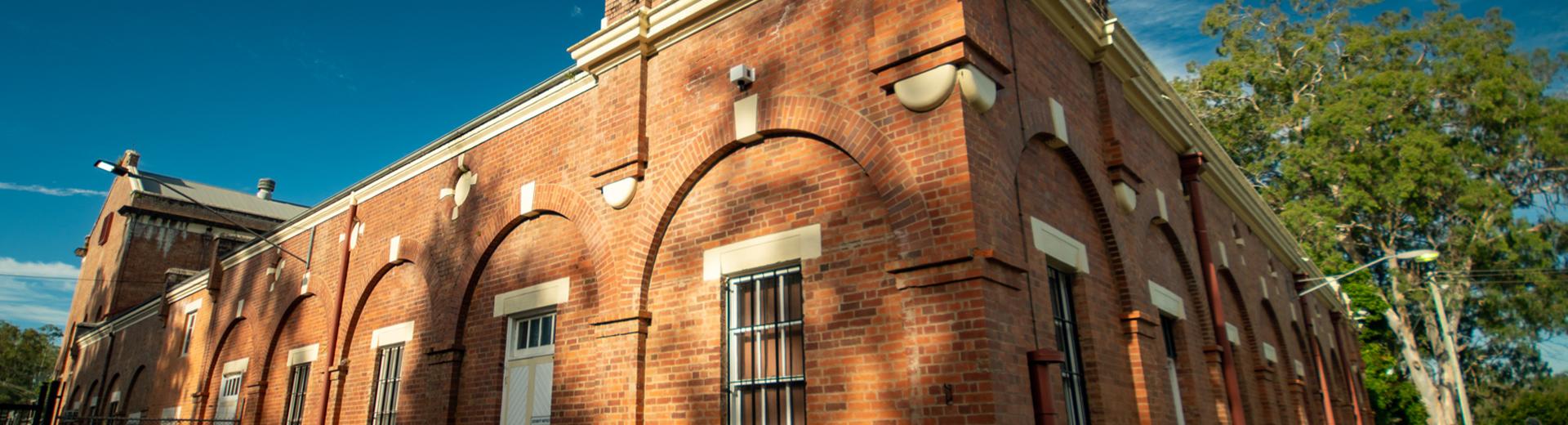
Refurbishing heritage workers cottages
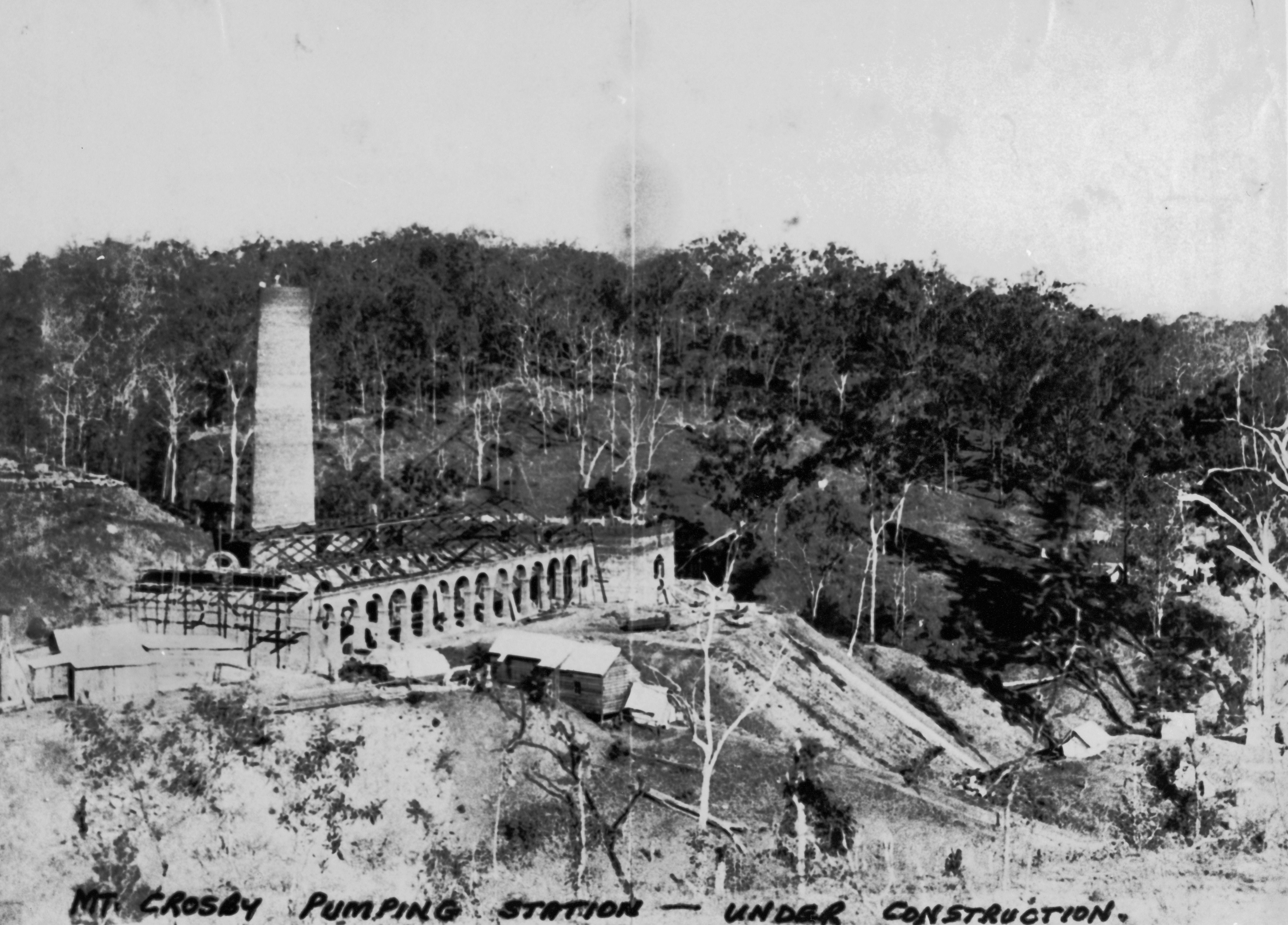
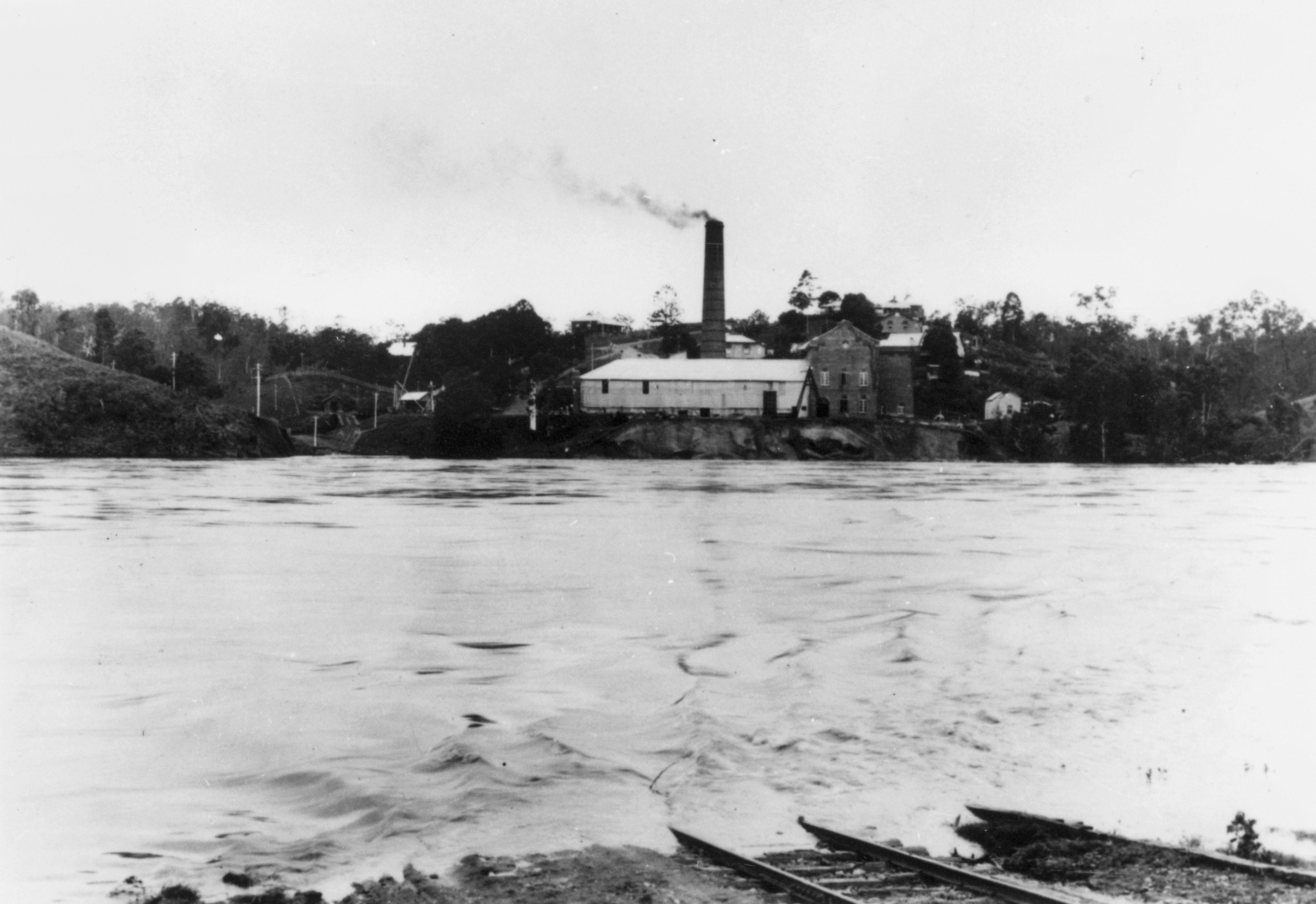
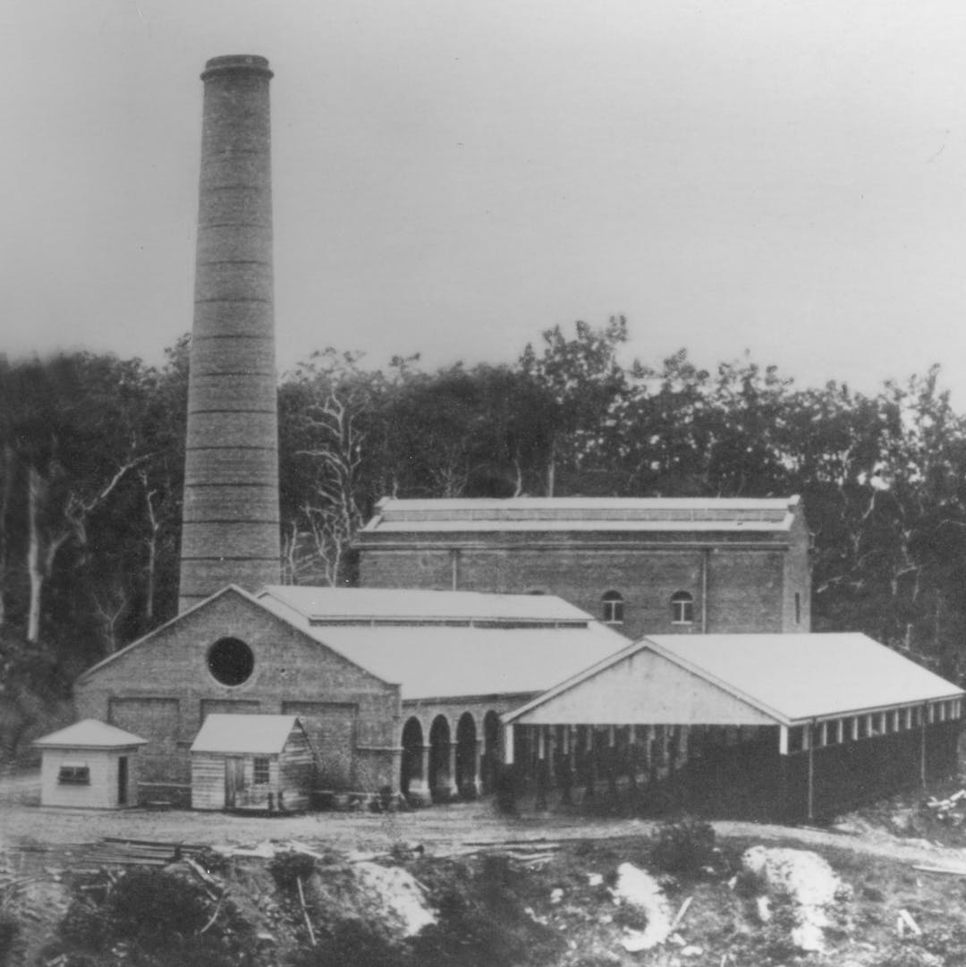
The Mount Crosby Water Treatment Plant complex was built in the late 19th century to expand the reticulated water supply for Brisbane. Throughout the 1880s, Brisbane suffered from repeat shortages of potable water and a permanent water supply needed to be found.
A group of cottages were built around the same time for the plant’s operators because of the relative isolation of Mount Crosby. A distinctive feature of the Works Hill site is the placement of the dwellings, which was designed to reflect the hierarchy of the occupants. The Works Hill Residential Precinct comprises two detached houses, four duplexes and one cottage, and is one of the few examples of this type of worker housing remaining in Queensland.
The houses were designed by Brisbane-based (Scottish-born) Charles McLay, who built Customs House in Brisbane, and are listed on Brisbane City Council’s heritage register.
Renovations have been undertaken to maintain their heritage value, meet regulatory requirements and improve liveability. Works have included the connection to water mains, waste-water treatment, improvements to electrical wiring and the installation of NBN connectivity.
Refurbishments were completed in January 2025.
In line with the Queensland Government Land Register Property Principles, Seqwater has retained ownership of cottages 102-104, for future service delivery given they are adjacent to core Seqwater assets. The cottages were used as emergency accommodation for Seqwater employees during Tropical Cyclone Alfred in March 2025.
Seqwater has leased cottages 106, 108, 109 and 110 to the public, through a residential property agency, to help provide affordable rental accommodation for the local community.
Cottage 107 remains vacant until additional works are completed.
Contact the team
If you have any questions about the project, please see the project FAQs below, or get in contact with the project team.
- Phone us 07 3432 7000 (during business hours)
- Email us [email protected]
- Complete the Online feedback form
Stay informed with project updates as this project progresses, by signing up to the newsletter subscription below.
- Project updates
- FAQs
- Resources
-
EBFRP Bulletin Update - September 2025
18 Sep 2025
The Mount Crosby Weir Bridge transformation is now officially complete, reopening as a safe and accessible pathway, with new heritage signage installed. Upgrade works continue to progress on the Critical Electrical Infrastructure project and substation. To read the final community update bulletin, click here.
EBFRP Bulletin Update - March 2025
25 Mar 2025
Construction works continue on the existing single-lane weir bridge, converting it to a shared pathway for pedestrians and cyclists. Upgrade works continue to progress on the Critical Electrical Infrastructure project and substation. To read the full bulletin, click here.
EBFRP Bulletin - November 2024
4 Nov 2024
Installation of heritage signage is now complete and providing visitors with an overview of the rich history of innovation and adaptation since the first Mount Crosby bridge was built in 1894. To read the full bulletin, click here.
EBFRP Bulletin Update - August 2024
30 Aug 2024
Seqwater opened the Mount Crosby new vehicle bridge to traffic on 26 March 2024, providing a more flood-resilient connection across the Brisbane River. To read the full bulletin, click here.
New Mount Crosby Vehicle Bridge opens to traffic
28 Mar 2024
The new Mount Crosby Vehicle Bridge is open, providing a more flood-resilient connection across the Brisbane River for local traffic.
Approximately three metres higher than the existing weir bridge, and with a combination steel and concrete guardrail design to better withstand flooding, the new bridge provides a more flood-resilient route and will deliver improved traffic flow over the Brisbane River in Mount Crosby.
More information is available in this Ministerial Media Statement
-
What is the East Bank Flood Resilience Program?
The Mount Crosby Water Treatment Plants are a critical part of the SEQ Water Grid and supply about 50 per cent of South East Queensland’s drinking water supply including the cities of Brisbane, Ipswich and Logan. Following the severe flood events in 2011 and 2013, Seqwater identified improvements across the SEQ Water Grid to improve resilience during all weather. The Brisbane River Catchment Flood Study showed the probability of floodwater inundating the East Bank Pump Station site was greater than previously thought, which is why Seqwater is focused on mitigating the flooding risk to this essential infrastructure. Seqwater’s East Bank Flood Resilience Program involves a number of improvements, to reduce flood risks to critical bulk water infrastructure along the Brisbane River in Mount Crosby. The Master Plan also aims to celebrate the area’s rich cultural heritage. Seqwater recognises the historical significance of the East Bank Pump Station and surrounding precinct and is committed to working with key stakeholders and the local community to revitalise the area as part of the Program.
How has the local community been involved?In early 2018, Seqwater developed a draft Master Plan for the East Bank Pump Station site, aimed at reducing flood risks, while also celebrating the area’s rich cultural heritage and increasing connectivity. The draft Master Plan was released for consultation in 2018, and the community was invited to attend an open day at the East Bank Pump Station.
Feedback included an interest in increasing connectivity throughout the area, better access to community facilities, and maintaining the site’s rich cultural heritage.
Why is the Mount Crosby East Bank Pump Station important?The East Bank Pump Station pumps up to 500 million litres (ML) of water a day to the East Bank Water Treatment Plant, which is a critical part of the SEQ Water Grid.
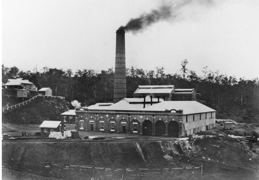
The historical Mount Crosby East Bank Pump Station is located near the Mount Crosby Weir Bridge along the Brisbane River. The pumping station was completed in 1893. Originally steam-powered, coal was transported via a tramway to fire the boilers, creating the steam that drove the pumping engines. This was the practice until steaming ceased in 1948.
Inside the station are eight wells and 16 high voltage pumps. River water is drawn from the weir pool through two intake towers and into the East Bank Pump Station. The pumps then move water to the treatment plant to be turned into safe drinking water.
What has Seqwater done about the flood risks since 2011?Following the severe flood events in 2011 and 2013, Seqwater identified improvements across the SEQ Water Grid to improve resilience during all weather. Since then, Seqwater has increased its chemical storage capacity at the plants so we can continue to treat water during severe weather, invested in improving catchment health, and enhanced our emergency response plans. Capital projects at the Mt Crosby Water Treatment Plants include:
- water proofing the wells inside the East Bank Pump Station
- repairing the river embankment near the East Bank Pump Station
- an alum upgrade to improve treatment processes at East Bank
- centrifuge upgrades to improve sludge handling at both East Bank and West Bank
- upgrading the onsite chemical storage capacity at the East Bank Water Treatment Plant.
Why is the substation being relocated to higher ground?The East Bank Pump Station pumps up to 500 million litres (ML) of water a day to the East Bank Water Treatment Plant, supplying drinking water to 1.6 million South East Queenslanders.
Following the severe flood events in 2011 and 2013, Seqwater identified improvements across the SEQ Water Grid to improve resilience during all weather. In 2016, Seqwater began a detailed assessment of the East Bank Pump Station site and its ability to cope and recover during a flood. The Brisbane River Catchment Flood Study showed the probability of floodwater inundating the East Bank Pump Station site was greater than previously thought, which is why Seqwater is focused on mitigating the flooding risk to this essential infrastructure.
After a flood, we need to get the Mount Crosby Water Treatment Plants operating as quickly as possible, because water is critical for human health and large volumes of water are needed for a flood clean up.
To improve flood resilience, a new substation is being constructed on higher ground and the old substation will be decommissioned.
Relocating the substation will ensure the pump station can be back up and running as quickly as possible after a major flood. The existing substation, located near the historic pump station building, is nearing end-of-life and will soon require replacement. Given the critical role of this infrastructure and flood risk associated with the current location, constructing a new substation on higher ground will help secure South East Queensland’s water supply during all weather.
Are you revegetating the site that was cleared for the new substation?Trees removed for the substation works will be offset via an extended rehabilitation program in the small valley below the substation site. The program will involve weed clearing and planting natives to achieve a natural regional ecosystem density. This has been conditioned in the Development Approval and will be overseen by Brisbane City Council and Seqwater.
Work will take 4-5 years before going into a maintenance period of two years. A concentrated effort in weed control is required so native plants will not have to complete with introduced listed weed species. This will take 12-24 months before planting can begin.
Planting will be undertaken by a rehab specialist and the establishment and growth of the native species will be carefully monitored. We anticipate that this rehabilitation zone will be restored to a natural bushland area and will assist in improving the amenity in this part of Stumers Road, with native food trees attracting more wildlife.
What is happening to the Mount Crosby weir bridge?The Mount Crosby weir was constructed in 1927 to create a pumping pool for the water treatment plant and with a bridge crossing to provide access to coal for the nearby pump station. The Master Plan involves constructing a new, higher vehicle bridge over the Brisbane River, and repurposing the existing heritage weir bridge for pedestrians. Repurposing the existing bridge will allow pedestrian access to the Mount Crosby Sportsground on Allawah Road. The pedestrian path opened in August 2025.
Why build a new vehicle bridge?During low-level flooding at Colleges Crossing, the Mount Crosby weir bridge becomes an access point for the community. The weir bridge is also critical to Seqwater operations and provides a link between the West Bank Water Treatment Plant (WTP) and East Bank WTP.
A new, higher and two-way vehicle bridge provides greater flood resilience than the existing one-way weir bridge. The new vehicle bridge is about 15 metres downstream of the existing Mount Crosby weir bridge on the Brisbane River. It is made of steel-reinforced concrete and about three metres higher than the existing weir bridge, 187 metres long and nine metres wide including the barriers and shoulders. The new vehicle bridge will better withstand flooding and dual lanes will improve the flow of traffic and ensure large vehicles such as trucks and buses can cross safely.
How did you protect the heritage elements of the weir bridge during construction of the new vehicle bridge?Seqwater is committed to protecting the heritage features of the weir bridge. Within the project site, four elements are listed on the Queensland Heritage Register including the Mount Crosby weir bridge, fish ladder, 1899 remnant bridge piers, and water intake tower.
The new vehicle bridge has been carefully designed to largely avoid impacting heritage elements in the area. This includes building the new vehicle bridge downstream of the weir bridge and placing the new bridge’s piers in between the remnant 1899 bridge piers. In addition, the new vehicle bridge does not impact the historic fish ladder on the downstream side of the weir.
During construction of the new vehicle bridge, the following measures were in place to mitigate construction impacts on some or all the heritage elements:
- Installation of vibration monitors on the existing weir bridge, remnant bridge piers and fish ladder
- Engaging an archaeologist to monitor works particularly when disturbing the ground during road approach remediation and piling
- Installing exclusion zones around heritage elements, to avoid accidental damage by plant equipment or vehicles
- Careful planning of all site works including boring, piling and equipment movement
- Obtaining necessary approvals from Department of Environment and Science, the Department of Transport and Main Roads, the Queensland Heritage Council, Brisbane City Council, and Seqwater.
What does the electrical infrastructure upgrade project involve?This project involves the upgrade of critical electrical infrastructure at the East Bank Pump Station, to ensure it continues to operate in peak condition.
The project will upgrade the existing motors, invest in critical spares, improve the flood resilience of the heritage listed pump station building, and upgrade electrical infrastructure to connect to the new substation.
Upgrades commenced in mid-2024, and are expected to be complete in early 2026 (construction conditions permitting).
-
File
East Bank Flood Resilience Project FACT SHEET July 2026
ImageMount Crosby Pumping Station Under Construction 1891 State Library of Queensland
ImageHistoric East Bank pump station, Mount Crosby - State Library of Queensland
ImagePumping Station At Mount Crosby 1892 State Library of Queensland
ImageHistoric Panoramic View of Mount Crosby Pumping Station 1892
ImagePumpStation1927_StateLibraryofQueensland.jpg
ImagePumps_StateLibraryofQueensland.jpg
Image1K1A7936.jpg
Image1K1A7928.jpg
Image1K1A7929.jpg
Image1K1A7921.jpg
Image1K1A7918.jpg
ImageEast Bank Pump Station - present day
ImageBridge_artist_impression_render_13.jpg
ImageBridge_artist_impression_render_12.jpg
FileMt Crosby EBFRP: New Bridge Fact Sheet